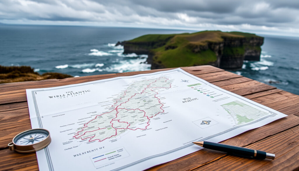
Wild Atlantic Way Map: Route Planner, Stages & Itinerary
Few drives match the pull of Ireland’s Wild Atlantic Way. Stretching 2,600 km from Kinsale in County Cork to the Inishowen Peninsula in County Donegal, it’s a route that turns the country’s western edge into a 14-stage road trip.
Total length: 2,600 km (1,616 miles) · Discovery Points: 157 · Recommended driving days: 7–14 days · Start point: Kinsale, County Cork · End point: Inishowen Peninsula, County Donegal
Quick snapshot
- Download from Fáilte Ireland national tourism authority
- Includes all 157 Discovery Points (Fáilte Ireland national tourism authority)
- Printable for offline use (Fáilte Ireland national tourism authority)
- Explore at The Irish Road Trip independent travel guide
- Zoom and click on hundreds of attractions (The Irish Road Trip independent travel guide)
- Sync with Google Maps for directions (The Irish Road Trip independent travel guide)
- Divided into 14 official stages by The Wild Atlantic Way official route site
- Each stage includes key attractions and suggested stopovers (The Wild Atlantic Way official route site)
- Distances range 100–220 km per stage (The Wild Atlantic Way official route site)
- 7-day express itinerary covers highlights
- 14-day full exploration allows deeper detours
- Customize based on your pace and interests
Eight key numbers, one pattern: the route’s scale demands advance planning. Below are the official specs that every traveller should know before packing the car.
| Attribute | Value | Source |
|---|---|---|
| Total Length | 2,600 km | The Wild Atlantic Way official route site |
| Number of Discovery Points | 157 | Wild Atlantic Way Online Guide |
| Number of Signature Discovery Points | 15 | Wild Atlantic Way Online Guide |
| Counties Covered | 9 | The Wild Atlantic Way official route site |
| Driving Time (non‑stop) | ~30 hours | Fáilte Ireland national tourism authority estimate |
| Recommended Duration | 7–14 days | Fáilte Ireland national tourism authority guidance |
| Starting Town | Kinsale, County Cork | The Wild Atlantic Way official route site |
| Ending Peninsula | Inishowen, County Donegal | The Wild Atlantic Way official route site |
The implication: these specs set the baseline for planning a west-coast journey.
Where does the Wild Atlantic Way begin and end?
Start point: Kinsale, County Cork
- The route officially begins at Kinsale harbour, a historic town 25 km south of Cork City. You’ll find the first Wild Atlantic Way signpost near the town centre. The Wild Atlantic Way official route site pinpoints the exact starting location.
End point: Inishowen Peninsula, County Donegal
- The route finishes at the Inishowen Peninsula in County Donegal – specifically the village of Muff. From there you can continue to Malin Head, Ireland’s northernmost point. The Wild Atlantic Way official route site details the final stage.
Total distance: 2,600 km
- The full circuit measures 2,600 km (about 1,616 miles), making it one of the world’s longest signposted coastal drives. Fáilte Ireland national tourism authority publishes a national map that tracks every kilometre.
The implication: starting in Kinsale and finishing in Donegal means driving the entire western seaboard. Most travellers break it into at least two weeks to avoid burnout.
How long does it take to drive the full Wild Atlantic Way?
7‑day itinerary overview
- A seven‑day schedule covers roughly 370 km per day. You’ll hit the most famous Discovery Points – Cliffs of Moher, Ring of Kerry, Connemara – but with minimal detours. Fáilte Ireland national tourism authority offers a 7‑day PDF itinerary that clusters stops by county.
14‑day itinerary overview
- A fortnight gives you time to linger: take Slea Head Drive, hike the Burren, or ferry to the Aran Islands. Average daily driving drops to 185 km, leaving afternoons free for walks and pub stops. The Irish Road Trip independent travel guide provides a detailed 14‑day stage breakdown.
Factors affecting drive time
- Narrow coastal roads (especially on the Dingle Peninsula and in West Cork) slow you to 40–60 km/h.
- Season matters: summer traffic around Killarney and Galway can add an hour per day.
- Ferry crossings (e.g., Killimer–Tarbert, Clare–Kerry) may save time but run on schedules. The Wild Atlantic Way official route site marks ferry routes on its stage maps.
A 7‑day trip means three to four hours behind the wheel daily. For travellers who want to actually hike, kayak, or visit pubs, 14 days is the realistic minimum.
The pattern: drive time more than doubles when you account for stops. The official 7‑day guide assumes you drive 5–6 hours per day; the 14‑day guide leaves afternoons free.
What is the most beautiful part of the Wild Atlantic Way?
The Cliffs of Moher
- Ireland’s most visited natural attraction, the Cliffs of Moher rise 214 metres above the Atlantic. The site draws over 1.5 million visitors annually. Visit Clare county tourism board confirms it’s the top‑rated Discovery Point on the route.
The Ring of Kerry
- A 179‑km circular loop around the Iveragh Peninsula, the Ring of Kerry delivers lake views, sandy beaches, and the Skellig Islands offshore. The Wild Atlantic Way official route site includes it as a Signature Discovery Point.
Slea Head Drive on the Dingle Peninsula
- Consistently rated one of Ireland’s most scenic roads, Slea Head Drive hugs the Dingle coastline with views of the Blasket Islands. It is part of the Wild Atlantic Way’s official route. The Irish Road Trip independent travel guide names it a must‑do on any itinerary.
Connemara National Park
- In County Galway, Connemara offers wild bogs, quartzite mountains (the Twelve Bens), and the Kylemore Abbey estate. The park is a designated Discovery Point. The Wild Atlantic Way official route site lists it under stage 7.
The Burren
- A surreal limestone landscape with ancient tombs and rare Arctic‑alpine flowers. The Burren National Park, near the Cliffs of Moher, is part of stage 5. Fáilte Ireland national tourism authority highlights its geological uniqueness.
Why this matters: the “most beautiful” is subjective, but each region offers a distinct landscape. If you only have time for one, Slea Head Drive and the Cliffs of Moher consistently top visitor polls.
Is Dingle part of the Wild Atlantic Way?
Yes — the Dingle Peninsula is a key section
- The Wild Atlantic Way runs the entire length of the Dingle Peninsula from Tralee to Dingle town and around Slea Head. The Wild Atlantic Way official route site includes it in the Kerry stage.
Slea Head Drive is a signature Discovery Point
- This 48‑km loop from Dingle town to Slea Head and back via Ballyferriter is one of 15 Signature Discovery Points. The Wild Atlantic Way official route site designates it as a must‑see.
Dingle town is a popular stop
- Known for its pubs, seafood, and Fungie the dolphin statue, Dingle town is the natural overnight stop for the peninsula. The Irish Road Trip independent travel guide recommends spending at least one night here.
Because Dingle is a long peninsula, many itineraries treat it as a half‑day detour. But the roads are narrow and parking limited in summer – plan for slow going.
The implication: Dingle is not a sidetrip; it’s an integral part of the route. Skipping it means missing one of the most photogenic 48 km in Ireland.
What is the best time of year to do the Wild Atlantic Way?
High season (June–August)
- Longest daylight (up to 17 hours), warmest temperatures (15–20°C). Expect heavy traffic on the Ring of Kerry and at the Cliffs of Moher. Accommodation must be booked months ahead. Fáilte Ireland national tourism authority notes that July and August are peak months for international visitors.
Shoulder season (May, September)
- Milder weather, fewer crowds, and lower prices. May offers blooming hedgerows; September has warm sea temperatures. The travel guide The Irish Road Trip independent travel guide recommends late May or early September as the sweet spot.
Low season (October–April)
- Shorter days (sunset before 5 pm in December), more rain, and some attractions closed. However, the landscape is dramatic with winter storms, and you’ll have the roads almost to yourself. The Wild Atlantic Way official route site warns that some Discovery Points may be inaccessible in poor weather.
The trade‑off: warm weather and long days in summer come with crowds. For a balance, aim for May or September when daylight is still generous and traffic moderate.
How can I plan my Wild Atlantic Way route using a map?
Download the official PDF map from Fáilte Ireland
- Visit Fáilte Ireland’s PDF page from the national tourism authority and save the file to your phone or print a copy.
- The PDF marks all 157 Discovery Points, ferry routes, and overnight towns.
- Use it offline – cell reception is spotty along the west coast.
Use the Discover Ireland interactive map
- Go to The Irish Road Trip interactive map from the independent travel guide – it aggregates hundreds of attractions with photos and links.
- Filter by category: beaches, castles, hikes, pubs.
- Click a pin to get directions via Google Maps.
Plan by stages: Cork to Donegal
- Open the official stage list from The Wild Atlantic Way official route site – stages 1 through 14.
- Decide how many stages to cover per day. Most travellers do 1–2 stages per day.
- Check the distance of each stage: the shortest is 100 km, the longest 216 km (Shannon Estuary stage).
Use Google Maps with Discovery Point waypoints
- Import the official list of Discovery Point coordinates (available from Fáilte Ireland’s open data) into Google My Maps.
- Create a custom layer with your chosen stops.
- Share the map with travel companions – Google Maps works offline when you download the area in advance.
The PDF map is perfect for offline planning. The interactive map helps you discover hidden gems. Use both, not one or the other.
Confirmed facts & What’s unclear
Confirmed facts
- Route begins in Kinsale, County Cork and ends in Inishowen, County Donegal. (The Wild Atlantic Way official route site)
- Total distance is 2,600 km. (The Wild Atlantic Way official route site)
- There are 157 Discovery Points. (Wild Atlantic Way Online Guide)
- Dingle Peninsula is part of the Wild Atlantic Way. (The Wild Atlantic Way official route site)
- Official PDF map is available from Fáilte Ireland. (Fáilte Ireland national tourism authority)
What’s unclear
- Exact best time to visit depends on personal weather tolerance and crowd preference.
- Which stage is “most beautiful” is subjective; multiple sections receive high ratings.
What local experts say
“The Wild Atlantic Way is more than a road – it’s a living showcase of Ireland’s geological and cultural heritage.”
Fáilte Ireland national tourism authority
“Planning with the official map and the interactive tool together gives you the best of both worlds – reliability and spontaneity.”
The Irish Road Trip independent travel guide
“Each of the nine counties offers something different – from the Burren’s lunar landscape to Donegal’s rugged cliffs.”
Local tourism board
For anyone planning a trip to Ireland’s west coast, the choice between a rushed 7‑day tour and a relaxed 14‑day journey is the single biggest decision. The official maps and stage breakdowns from Fáilte Ireland and The Wild Atlantic Way give you the tools to tailor the route to your pace. For the traveller who values time in a pub or a cliffside hike over ticking boxes, the answer is clear: give yourself two weeks, or plan to return.
thewildatlanticway.com, wildernessireland.com, images.ireland.com
For a detailed route planner and downloadable PDF, refer to the official Wild Atlantic Way map which breaks down the entire 2,500 km journey into manageable stages.
Frequently asked questions
What is the total length of the Wild Atlantic Way?
The route is 2,600 km (about 1,616 miles) from Kinsale to Inishowen. (The Wild Atlantic Way official route site)
Are there toll roads on the Wild Atlantic Way?
No toll roads on the route itself. The only tolls in Ireland are on the M50 near Dublin, which is off the route.
Can I cycle the Wild Atlantic Way?
Yes, but the full 2,600 km is demanding – most cyclists break it into 10–14 days. The route is not a dedicated cycle path; you share narrow roads with cars. (The Wild Atlantic Way official route site)
Do I need a car to experience the Wild Atlantic Way?
A car offers the most flexibility, but bus tours and e‑bike rentals are available in popular sections like the Dingle Peninsula and the Cliffs of Moher.
Is the Wild Atlantic Way signposted?
Yes, the route is marked by brown signs with a white zigzag pattern. (Helena Bradbury travel blog) confirms the signage is consistent and easy to follow.
What accommodation options are available along the route?
Options range from B&Bs and hostels to luxury hotels. Most towns en route have at least one guesthouse. Fáilte Ireland national tourism authority lists accommodations by county.
Are there guided tours of the Wild Atlantic Way?
Yes, several tour operators offer multi‑day guided tours. Check Discover Ireland official tourism website for listings.
Can I complete the Wild Atlantic Way in 5 days?
Technically yes, but you’d drive 520 km per day with almost no stops – not recommended for enjoyment. Minimum realistic is 7 days.
More related posts
 Amanda Bynes Movies and TV Shows: Full Career Guide (2026)
 Kieran Moran Car Sales: Used Cars in Galway & Reviews
 Tung Tung Tung Sahur – Viral Ramadan TikTok Trend Explained
 Most Successful English Club: Liverpool’s 70 Trophies Lead
 Celtic vs St Mirren: 6-2 AET Result, Highlights & TV Guide
 EuroDreams Ticket Sold in Westmeath: €2,000 Monthly Win
 Houses for Sale in Clontarf: Prices, Areas & Lifestyle Guide
 Phoenix Group Share Price: Buy, Sell, or Hold? 2025
