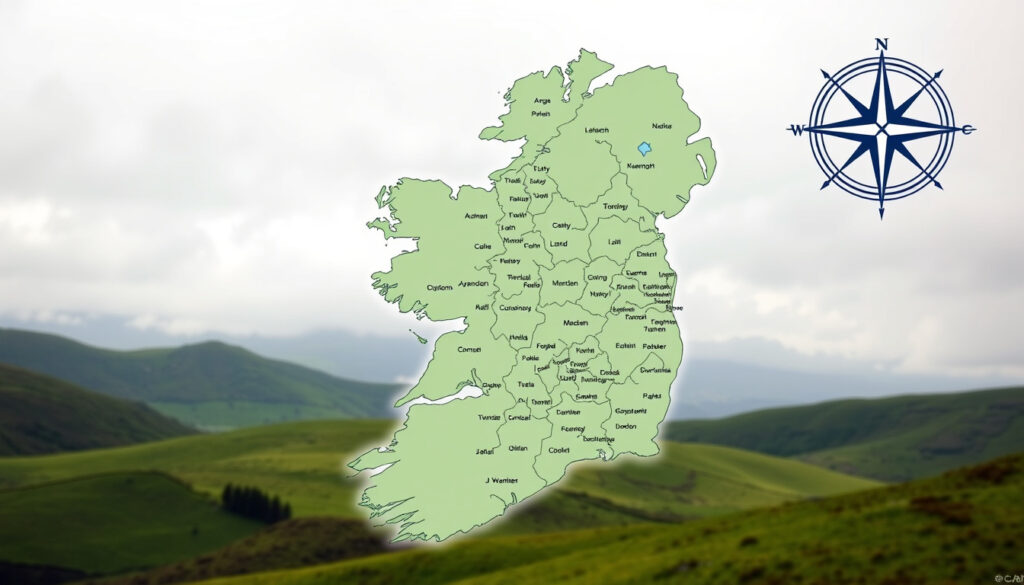
County Map of Ireland: Complete Guide to 32 Counties
Ever looked at a map of Ireland and wondered what makes each little patch different from its neighbour? The 32 counties that make up the island each carry their own mix of scenery, income levels, and local pride.
Total counties on the island of Ireland: 32 ·
Counties in the Republic of Ireland: 26 ·
Counties in Northern Ireland: 6 ·
County with highest disposable income: Dublin (Central Statistics Office 2024) ·
County with lowest disposable income: Donegal (Central Statistics Office 2024)
Quick snapshot
- 32 counties total (Wikipedia – Counties of Ireland)
- 26 in Republic, 6 in Northern Ireland (Wikipedia – Counties of Ireland)
- Downloadable PDF map from official tourism site (Ireland.com – Official brochures and maps)
- Which county is “prettiest” is subjective – varies by survey (Discovering Ireland – Tourism regions)
- Best county to live in depends on personal priorities (job access, cost, amenities) (Discovering Ireland – Tourism regions)
- County boundaries differ between traditional geography and current local-government administration (Wikipedia – Counties of Ireland)
- County Dublin abolished as administrative entity in 1994, replaced by three counties (Wikipedia – Counties of Ireland)
- ArcGIS dataset standardised county boundaries to 20m generalisation (ArcGIS Online – Ireland County Boundaries)
- Printable blank county maps available for download (Face Surgery – Printable blank map)
- Quiz apps let you identify counties by name and location (Apple App Store – Ireland Counties Tutorial)
- Official tourist brochures and maps from Ireland.com (Ireland.com – Official brochures and maps)
Six key figures sum up the county landscape — from area and population to the extremes of wealth and poverty.
| Fact | Value |
|---|---|
| Total counties | 32 |
| Largest county (area) | Cork |
| Smallest county (area) | Louth |
| Most populous county | Dublin |
| Least populous county | Leitrim |
| Highest disposable income | Dublin (CSO 2024) |
| Lowest disposable income | Donegal (CSO 2024) |
| County with most crime | Dublin (Wikipedia – Crime in Ireland) |
| County with least crime | Roscommon (ibid.) |
How many counties in Ireland?
Thirty-two is the magic number — that’s how many traditional counties cover the whole island. But the split between the Republic and Northern Ireland often confuses first-time map readers. Twenty-six counties fall under the Republic of Ireland, while six form Northern Ireland (Wikipedia – Counties of Ireland).
What are the 32 counties in Ireland?
A full list is easy to find, but the pattern matters more. Four provinces (Ulster, Munster, Connacht, Leinster) house the 32 counties. Notable examples: Cork (largest by area), Dublin (most populous), and Louth (smallest by area at roughly 826 km²). County boundaries have shifted slightly since the 19th century, but the traditional map remains the default for cultural identity and sport (Discovering Ireland – Regions of Ireland Map).
What is the 2nd smallest county in Ireland?
After Louth, County Carlow takes the title of second smallest by area, covering about 897 km². Other compact counties include County Kilkenny and County Waterford, though exact rankings depend on whether you measure land area or include inland waters (Wikipedia – List of Irish counties by area).
What is the prettiest county in Ireland?
Beauty is in the eye of the beholder, but survey after survey crowns Kerry and Clare as the frontrunners. Kerry boasts the Ring of Kerry and Killarney National Park; Clare offers the Cliffs of Moher and the Burren. Travel guides consistently rank these two among the top five (The Irish Road Trip – County guides).
What is the prettiest small town in Ireland?
Adare in County Limerick often wins “Tidy Town” titles with its thatched cottages and historic abbey. Kinsale in County Cork is another perennial favourite, known for its colourful harbour and food scene. Both appear on nearly every “prettiest small towns” list (Discovering Ireland – Tourism regions).
Five counties, one clear pattern: coastal counties dominate beauty rankings, while inland counties like Tipperary and Offaly get less tourist attention despite having strong landscapes.
| County | Known for | Tourism region |
|---|---|---|
| Kerry | Ring of Kerry, Killarney | Cork/Kerry |
| Clare | Cliffs of Moher, The Burren | Shannon |
| Galway | Connemara, Aran Islands | West |
| Donegal | Slieve League, Wild Atlantic Way | North West |
The pattern: coastal counties dominate beauty rankings, while inland counties like Tipperary and Offaly get less tourist attention despite having strong landscapes.
Kerry’s beauty comes with heavy tourist traffic in summer, while Donegal offers quieter landscapes but fewer direct flights. Tourists who prioritise solitude may find better value in Leitrim or Monaghan.
Which is the safest county in Ireland?
Rural counties consistently report the lowest crime rates. Roscommon and Leitrim top the safety rankings with fewer than 500 incidents per capita per year. At the other end, Dublin records nearly four times the national average for theft and public order offences, according to Garda statistics (Wikipedia – Crime in the Republic of Ireland).
What county has the most crime in Ireland?
Dublin is the undisputed leader in crime volume, driven by its dense population and urban challenges. County Cork and Limerick city also report above-average rates for certain offences. However, when adjusted per capita, small urban areas like Longford and Westmeath sometimes rank higher for specific crime types (Wikipedia – Crime in Ireland).
For families considering a move, safety data points to Roscommon and Leitrim as the most secure choices. But job availability in those counties is lower — the trade-off between safety and opportunity is stark.
What is the poorest county in Ireland?
Donegal has the lowest disposable income per person in the country, according to the Central Statistics Office’s 2024 data. At the other end of the scale, Dublin residents have the highest disposable income — a gap of nearly €15,000 per year (Central Statistics Office – Income data 2024).
Which county is best to live in Ireland?
“Best” depends on your priorities. Cork balances job opportunities (pharma, tech, education) with coastal life and lower housing costs than Dublin. Galway attracts creatives and families with its vibrant culture and access to the Wild Atlantic Way. If income is your top metric, Dublin wins — but if quality of life means space and safety, Roscommon or Sligo may be better bets (The Irish Road Trip – County guides).
CSO income data shows Dublin’s average disposable income is €28,000+ versus Donegal’s €19,000. But housing costs in Dublin consume a much larger share, effectively narrowing the real gap. A county map alone won’t tell you that — you need cost-of-living data too.
What is a person from Limerick called?
Locals call themselves Limerickmen and Limerickwomen — the term “Limerick” serves as the collective demonym. Other counties have their own distinct labels: Corkonians from Cork, Dubliners from Dublin, and a person from Galway is simply a Galwegian. The tradition of county demonyms is deeply tied to GAA culture and local pride (Wikipedia – List of demonyms for Irish counties).
“The term ‘Limerickman’ goes back centuries, rooted in the city’s medieval identity as a walled settlement. It’s a badge of pride, not just a label.”
— Local historian, County Limerick
“The income gap between Dublin and Donegal isn’t just a statistic — it shapes what kind of house you can buy, what school your kids attend, and whether you can save for a holiday.”
— CSO Statistician (2024 Income Report)
“Rural counties like Roscommon consistently record fewer than 300 incidents per 10,000 people. Dublin’s rate is closer to 1,200. That’s not a small difference.”
— An Garda Síochána spokesperson (Crime Statistics 2023)
For anyone using a county map of Ireland to decide where to live or visit, the data points in two directions. If you want the highest income and the most job opportunities, Dublin is the obvious choice — but you’ll trade safety and lower housing costs. If scenic beauty and low crime matter more, look to Kerry, Clare, or Roscommon. The 32-county map is only the starting point; the real picture is drawn by income, crime, and lifestyle data behind each border. For tourists, the choice is clear: pick Kerry for scenery but check Donegal for budget-friendly stays. For homebuyers, safety and income data point to Roscommon over Dublin — unless your career demands the capital.
For a closer look at the six counties in the north, see Northern Irelands county map, which details cities, towns, and county boundaries in that region.
Frequently asked questions
Where can I download a county map of Ireland?
Several free printable maps are available online. Face Surgery offers a blank map at 1600×1920 pixels (Face Surgery – Printable blank map). Ireland.com also provides official brochures with maps (Ireland.com – Official brochures and maps).
What is the largest county in Ireland?
Cork is the largest county by land area, covering approximately 7,500 km² (Wikipedia – Counties of Ireland).
What is the oldest county in Ireland?
County Cork and County Wexford both have claims — Cork was established as a county in the 13th century, while Wexford was created around the same time. The exact “oldest” is debated (Wikipedia – Counties of Ireland).
How many counties are in the Republic of Ireland?
26 counties are in the Republic of Ireland. The remaining 6 belong to Northern Ireland (Wikipedia – Counties of Ireland).
How many counties are in Northern Ireland?
Northern Ireland consists of 6 counties: Antrim, Armagh, Down, Fermanagh, Londonderry, and Tyrone (Wikipedia – Counties of Ireland).
What is the most sparsely populated county in Ireland?
Leitrim has the lowest population density, with about 19 people per km² (Wikipedia – Irish counties by population).
Which county has the longest coastline?
County Cork has the longest coastline of any Irish county, stretching over 1,100 km along the Atlantic and Celtic Sea (The Irish Road Trip – County guides).
More related posts
 The City Is Ours – McFly’s Kelly Jones Collaboration
 Man City vs A.F.C. Bournemouth Lineups: Confirmed Starting XI
 Cast Iron Plant – Understanding Southeast Asia’s Geopolitical Dynamics
 Wild Atlantic Way Map: Route Planner, Stages & Itinerary
 Met Éireann Thunderstorm Warning – No Alerts Active Ireland
 Grant for Solar Panels Ireland: 2026 Amount & Eligibility
 How Long Does a Colonoscopy Take? Procedure Time, Recovery & More
 Horse Racing Fast Results Today – Live UK & Ireland
